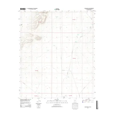
2013 Map of Magdalena Gap
USGS Topo · Published 2013About this map
Magdalena Gap defines the high point of this high-desert landscape in Doña Ana County, where the terrain breaks between the peaks and the broad expanse of Apache Flats. This 2013 survey illustrates a region shaped by ephemeral water management, essential for ranching and survival in the arid Southwest. A network of county roads, including CO Road C003 and CO Road C008, connects a series of named water catchments and basins such as Georgie Tank, Blackburn Tank, and Coldiron Tank. The drainage patterns are clearly marked by Candler Draw and Mason Draw, showing how seasonal runoff is channeled through the desert floor. This map is a precise record of the infrastructure and land divisions, including t23s r4w, that characterize this part of New Mexico.
Find a feature on this map
26 named features on this map. Tap any name to fly to it.
Don’t see what you’re looking for? This feature index may not catch every label — zoom into the map to look around manually.
Map Details
Editions of this 2013 Magdalena Gap Map
This is the sole edition of this map. No revisions or reprints were ever made.
Other maps of this area

1941 · Aden
USGS Topo · 1:62,500

1943 · Aden
USGS Topo · 1:62,500

1943 · Corralitos Ranch
USGS Topo · 1:62,500

1955 · Las Cruces
USGS Topo · 1:250,000

1958 · Las Cruces
USGS Topo · 1:250,000

1972 · Cambray
USGS Topo · 1:24,000

1972 · Good Sight Peak NE
USGS Topo · 1:24,000

1972 · Lazy E Ranch
USGS Topo · 1:24,000
1982 · Deming
USGS Topo · 1:100,000
1985 · Magdalena Gap
USGS Topo · 1:24,000