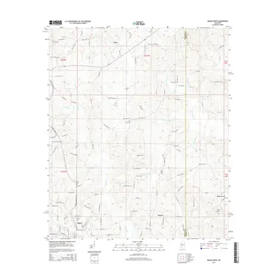
2015 Map of Magee North
USGS Topo · Published 2015About this map
Magee sits at the southern edge of this Simpson County landscape, serving as a focal point for a network of country roads that stretch into the surrounding timber and farmland. The terrain is defined by the dendritic drainage patterns of Okatoma Cr and its many tributaries, including Hatchapaloo Cr and Little Hatchapaloo Cr. These waterways carve through the low hills, influencing the placement of early homesteads and community centers. Smaller settlements like Upton to the north and Shady Grove to the east represent the rural character of the region during this era.
Find a feature on this map
79 named features on this map. Tap any name to fly to it.
Don’t see what you’re looking for? This feature index may not catch every label — zoom into the map to look around manually.
Map Details
Editions of this 2015 Magee North Map
This is the sole edition of this map. No revisions or reprints were ever made.
Other maps of this area

1935 · White Oak
USGS Topo · 1:24,000

1953 · Hattiesburg
USGS Topo · 1:250,000

1953 · Meridian
USGS Topo · 1:250,000

1957 · Meridian
USGS Topo · 1:250,000

1958 · Hattiesburg
USGS Topo · 1:250,000

1965 · Meridian
USGS Topo · 1:250,000

1968 · White Oak
USGS Topo · 1:24,000
1968 · Puckett
USGS Topo · 1:24,000

1968 · Raleigh
USGS Topo · 1:24,000

1970 · Mendenhall East
USGS Topo · 1:24,000