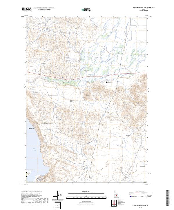
2023 Map of Magic Reservoir East
USGS Topo · Published 2023About this map
The Big Wood River winds through the Wood River Valley, anchoring a landscape defined by significant topographic shifts between the Smoky Mountains and the Timmerman Hills. The eastern reach of the Magic Reservoir dominates the southwest corner, where the small settlement of Magic City is situated along the shoreline. This geography illustrates a transition from high-elevation ridges like Wind Ridge and Ditto Hill down to the broad alluvial plains of Rye Grass Flat and Sonners Flat.
Find a feature on this map
40 named features on this map. Tap any name to fly to it.
Don’t see what you’re looking for? This feature index may not catch every label — zoom into the map to look around manually.
Map Details
Editions of this 2023 Magic Reservoir East Map
This is the sole edition of this map. No revisions or reprints were ever made.
Other maps of this area

1955 · Hailey
USGS Topo · 1:250,000

1957 · Bellevue
USGS Topo · 1:62,500

1957 · Bellevue
USGS Topo · 1:24,000

1959 · Hailey
USGS Topo · 1:250,000

1962 · Hailey
USGS Topo · 1:250,000

1979 · Shoshone Ice Cave
USGS Topo · 1:24,000
1979 · Tapper Lake
USGS Topo · 1:24,000
1979 · Gannett
USGS Topo · 1:24,000

1979 · Summit Reservoir
USGS Topo · 1:24,000
1979 · Seamans Creek
USGS Topo · 1:24,000