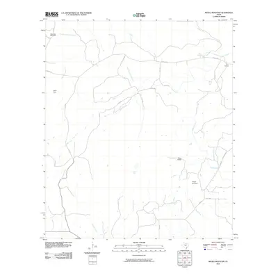
2010 Map of Magill Mountain
USGS Topo · Published 2010About this map
Magill Mountain and Shin Oak Mountain dominate this Central Texas landscape, defining a terrain of high ridges and narrow drainage basins. The area is characterized by a complex network of seasonal and perennial watercourses, including the North Fork Cherokee Creek and Hickory Creek, which carve through the limestone-rich topography. These waterways have long influenced local land use, with features like Hext Spring and Cedar Hollow indicating reliable water sources in an otherwise dry environment.
Find a feature on this map
31 named features on this map. Tap any name to fly to it.
Don’t see what you’re looking for? This feature index may not catch every label — zoom into the map to look around manually.
Map Details
Editions of this 2010 Magill Mountain Map
This is the sole edition of this map. No revisions or reprints were ever made.
Other maps of this area

1885 · San Saba
USGS Topo · 1:125,000

1887 · Llano
USGS Topo · 1:125,000

1894 · San Saba
USGS Topo · 1:125,000

1894 · Llano
USGS Topo · 1:125,000

1904 · Llano
USGS Topo · 1:125,000

1909 · Llano
USGS Topo · 1:125,000

1918 · Llano
USGS Topo · 1:125,000

1931 · Bend
USGS Topo · 1:62,500

1954 · Brownwood
USGS Topo · 1:250,000

1954 · Llano
USGS Topo · 1:250,000