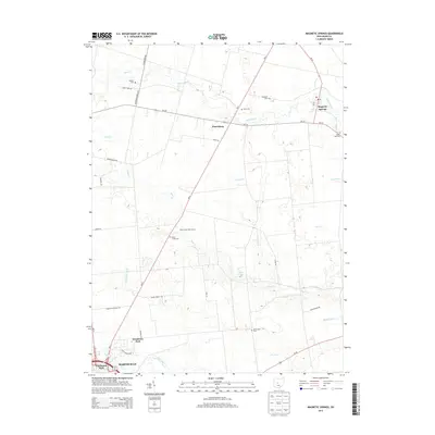
2013 Map of Magnetic Springs
USGS Topo · Published 2013About this map
Magnetic Springs and the northern outskirts of Marysville anchor this 2013 survey of central Union County. The landscape is defined by the drainage patterns of Bokes Creek, Blues Creek, and Grassy Run, which cut through the agricultural terrain between Pharisburg and the southern parklands. The map reveals a high concentration of small family and community burial grounds, such as Maskill Cemetery, Scott Cemetery, and Hopewell Cemetery, providing essential data points for local genealogists. In the south, the transition from rural acreage to the residential fringes of Marysville is marked by Woodview Park and Fleetwood Park. This edition documents the road network connecting these points, including the diagonal path of Oh-4 and the eastern route of Oh-37, which intersects with the village of Magnetic Springs near the Post Office.
Find a feature on this map
45 named features on this map. Tap any name to fly to it.
Don’t see what you’re looking for? This feature index may not catch every label — zoom into the map to look around manually.
Map Details
Editions of this 2013 Magnetic Springs Map
This is the sole edition of this map. No revisions or reprints were ever made.
Other maps of this area

1901 · Dublin
USGS Topo · 1:62,500

1903 · Dublin
USGS Topo · 1:62,500

1913 · Richwood
USGS Topo · 1:62,500

1915 · Richwood
USGS Topo · 1:62,500

1916 · Milford Center
USGS Topo · 1:62,500

1924 · Delaware
USGS Topo · 1:62,500

1925 · Delaware
USGS Topo · 1:62,500

1944 · Richwood
USGS Topo · 1:62,500

1944 · Milford Center
USGS Topo · 1:62,500

1944 · Delaware
USGS Topo · 1:62,500