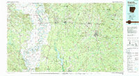
1986 Map of Magnolia
USGS Topo · Published 1988About this map
The Red River creates a meandering natural border along the western edge of this 1980s survey, where the river's dynamic path is marked by remnants like First Old River Lake and 1927 Cut-off Lake. This landscape is defined by the heavy presence of an extensive Oil and Gas Field, signaling the region's industrial backbone across Columbia and Lafayette counties. The terrain moves from the low, wet bottoms of the Sulphur River State Wildlife Management Area toward the rolling interior where Magnolia serves as a primary regional hub.
Find a feature on this map
114 named features on this map. Tap any name to fly to it.
Don’t see what you’re looking for? This feature index may not catch every label — zoom into the map to look around manually.
Map Details
Editions of this 1986 Magnolia Map
2 editions found
Other maps of this area

1901 · Gurdon
USGS Topo · 1:125,000

1903 · Camden
USGS Topo · 1:125,000

1907 · Atlanta
USGS Topo · 1:62,500

1909 · Texarkana
USGS Topo · 1:62,500

1910 · Atlanta
USGS Topo · 1:62,500

1922 · Sarepta
USGS Topo · 1:62,500

1924 · Sarepta
USGS Topo · 1:62,500

1932 · Hosston NW
USGS Topo · 1:31,680

1932 · Hosston NE
USGS Topo · 1:31,680

1944 · Kildare
USGS Topo · 1:62,500