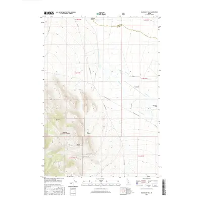
2017 Map of Mahogany Hill
USGS Topo · Published 2017About this map
The Pahsimeroi Valley serves as a prominent ranching corridor in this high-altitude section of central Idaho, where the Pahsimeroi River flows northward toward the county line between Lemhi Co and Custer Co. The landscape transition is sharp, moving from the level valley floor and its private holdings, including the Flying Joseph Ranch Airport, into the protected slopes of the Challis National Forest.
Find a feature on this map
27 named features on this map. Tap any name to fly to it.
Don’t see what you’re looking for? This feature index may not catch every label — zoom into the map to look around manually.
Map Details
Editions of this 2017 Mahogany Hill Map
This is the sole edition of this map. No revisions or reprints were ever made.
Other maps of this area

1935 · Borah Peak
USGS Topo · 1:125,000

1938 · Borah Peak
USGS Topo · 1:125,000

1955 · Dubois
USGS Topo · 1:250,000

1956 · Patterson
USGS Topo · 1:62,500

1956 · Donkey Hills
USGS Topo · 1:62,500

1956 · Doublespring
USGS Topo · 1:62,500

1956 · May
USGS Topo · 1:62,500

1958 · Dubois
USGS Topo · 1:250,000

1980 · Leadore
USGS Topo · 1:100,000
1989 · May
USGS Topo · 1:24,000