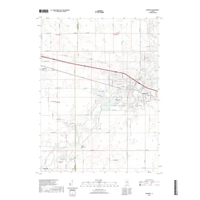
2018 Map of Mahomet
USGS Topo · Published 2018About this map
The Sangamon River meanders through the heart of the central Illinois prairie, anchoring the community of Mahomet as it expands toward the wooded river valley. By the late 2010s, this area shows a distinctive blend of traditional agriculture and residential growth, with modern developments like Spring Lake and the River Valley Rnch contrasting against the older rural grid. The map is a significant resource for those tracing local lineages, as it meticulously identifies numerous small burial grounds including Dunkard Cem, Argo Cem, and the Seymour Methodist Episcopal Cem. Further west, the village of Mansfield sits near the headwaters of Madden Cr, while the small settlement of Centerville marks the southern reach near the confluence of Camp Cr and S Fork Camp Cr. This survey illustrates how the landscape evolved around these watercourses and historical cemeteries as the region modernized.
Find a feature on this map
84 named features on this map. Tap any name to fly to it.
Don’t see what you’re looking for? This feature index may not catch every label — zoom into the map to look around manually.
Map Details
Editions of this 2018 Mahomet Map
This is the sole edition of this map. No revisions or reprints were ever made.
Other maps of this area

1907 · Mahomet
USGS Topo · 1:62,500

1928 · Gibson City
USGS Topo · 1:62,500

1937 · Monticello
USGS Topo · 1:48,000

1943 · Monticello
USGS Topo · 1:62,500

1952 · Arrowsmith
USGS Topo · 1:62,500

1957 · Gibson City
USGS Topo · 1:62,500

1957 · Rising
USGS Topo · 1:24,000

1957 · Mahomet
USGS Topo · 1:62,500

1957 · Bondville
USGS Topo · 1:24,000

1958 · Peoria
USGS Topo · 1:250,000