
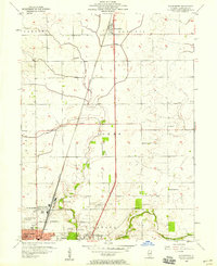
1957 Map of Bondville
USGS Topo · Published 1958About this map
The growing western edge of Champaign meets the agricultural heart of the county in this late-1950s survey. The landscape is defined by the transition from urban neighborhoods like Kenwood to the rural townships of Scott, Champaign, Colfax, and Tolono. Infrastructure of the era is prominent, with the Illinois Central Terminal and the Illinois Central railroad lines serving the region's transport needs. To the south, the expansive University of Illinois Airport stands near Savoy, complete with its Beacon and proximity to Prairieview Cemetery.
Find a feature on this map
36 named features on this map. Tap any name to fly to it.
Don’t see what you’re looking for? This feature index may not catch every label — zoom into the map to look around manually.
Map Details
Editions of this 1957 Bondville Map
This is the sole edition of this map. No revisions or reprints were ever made.
Other maps of this area

1906 · Urbana
USGS Topo · 1:62,500

1907 · Mahomet
USGS Topo · 1:62,500

1950 · Tuscola
USGS Topo · 1:62,500

1956 · Villa Grove
USGS Topo · 1:62,500

1957 · Urbana
USGS Topo · 1:62,500

1957 · Urbana
USGS Topo · 1:24,000

1957 · Rising
USGS Topo · 1:24,000

1957 · Mahomet
USGS Topo · 1:62,500
1957 · Thomasboro
USGS Topo · 1:24,000

1958 · Peoria
USGS Topo · 1:250,000