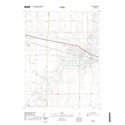
2021 Map of Mahomet
USGS Topo · Published 2021About this map
The Sangamon River carves a winding path through the heart of this landscape, anchoring the village of Mahomet and the surrounding agricultural lands of Champaign and Piatt counties. This modern topographic study reveals a deeply historical cemetery network, including Riverside Cem, Middletown Cem, and Bryan Cem within the village limits, while outlying plots like Argo Cem and Dunkard Cem mark earlier rural congregations. The terrain is defined by the intersection of water and transport, with Lake of the Woods and Fountain Lake providing significant recreational landmarks near the river's bend. Along the western edge, the settlement of Mansfield sits near Madden Cr, while the small community of Centerville occupies the southwestern corner, illustrating the enduring township grid and local road network that has structured this part of Illinois for generations.
Find a feature on this map
103 named features on this map. Tap any name to fly to it.
Don’t see what you’re looking for? This feature index may not catch every label — zoom into the map to look around manually.
Map Details
Editions of this 2021 Mahomet Map
This is the sole edition of this map. No revisions or reprints were ever made.
Other maps of this area

1907 · Mahomet
USGS Topo · 1:62,500

1928 · Gibson City
USGS Topo · 1:62,500

1937 · Monticello
USGS Topo · 1:48,000

1943 · Monticello
USGS Topo · 1:62,500

1952 · Arrowsmith
USGS Topo · 1:62,500

1957 · Gibson City
USGS Topo · 1:62,500

1957 · Rising
USGS Topo · 1:24,000

1957 · Mahomet
USGS Topo · 1:62,500

1957 · Bondville
USGS Topo · 1:24,000

1958 · Peoria
USGS Topo · 1:250,000