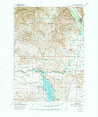
1967 Map of Mahoney Butte
USGS Topo · Published 1991About this map
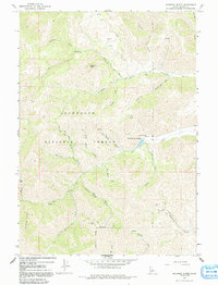
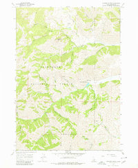
Clarendon Hot Springs and the surrounding terrain of the Sawtooth National Forest define this 1960s landscape in Blaine County. The map documents a rugged interior shaped by both geological activity and resource extraction, with several unnamed Mines and specific sites like the Red Cloud Mine and Democrat Mine situated within the deep gulches. A legacy of early timber work is noted at the Sawmill on Greenhorn Creek, while recreational use is emerging at Wolftone Campground and Bridge Campground. Steep-sided valleys such as Democrat Gulch and Wolf Tone Gulch converge toward the larger drainage of Deer Creek, illustrating the complex network of trails and primitive roads used by miners and early forest travelers.
Find a feature on this map
36 named features on this map. Tap any name to fly to it.
Don’t see what you’re looking for? This feature index may not catch every label — zoom into the map to look around manually.
Map Details
Editions of this 1967 Mahoney Butte Map
3 editions found
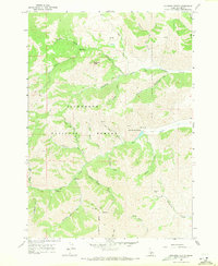
Other maps of this area

1895 · Hailey
USGS Topo · 1:125,000

1897 · Hailey
USGS Topo · 1:125,000

1900 · Sawtooth
USGS Topo · 1:125,000

1955 · Hailey
USGS Topo · 1:250,000
1957 · Bellevue
USGS Topo · 1:62,500
1957 · Blaine
USGS Topo · 1:62,500
1957 · Bellevue
USGS Topo · 1:24,000

1959 · Hailey
USGS Topo · 1:250,000

1962 · Hailey
USGS Topo · 1:250,000
1967 · Mahoney Butte
USGS Topo · 1:24,000