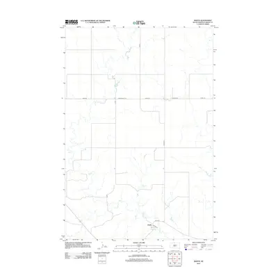
2012 Map of Mahto
USGS Topo · Published 2012About this map
The small community of Mahto serves as a central point in this sparsely populated section of Corson County. The landscape is defined by the winding course of Oak Cr, which carves through the undulating plains and provides a natural landmark across the quadrangle. Transportation in the early 21st century follows a grid-like pattern of rural roads, including Kenel Rd and Corson Road 3110, which connect isolated homesteads and ranches to the local hub. The presence of Railway St in the vicinity of the settlement highlights the enduring influence of transport networks on the development and survival of these remote Great Plains outposts.
Find a feature on this map
12 named features on this map. Tap any name to fly to it.
Don’t see what you’re looking for? This feature index may not catch every label — zoom into the map to look around manually.
Map Details
Editions of this 2012 Mahto Map
This is the sole edition of this map. No revisions or reprints were ever made.
Other maps of this area

1953 · McIntosh
USGS Topo · 1:250,000

1956 · Wakpala NW
USGS Topo · 1:24,000

1956 · Little Eagle
USGS Topo · 1:24,000

1956 · Wakpala
USGS Topo · 1:24,000

1958 · McIntosh
USGS Topo · 1:250,000

1966 · Mahto NE
USGS Topo · 1:24,000

1966 · McLaughlin
USGS Topo · 1:24,000

1966 · McLaughlin NE
USGS Topo · 1:24,000

1966 · Mahto
USGS Topo · 1:24,000

1966 · Mahto NW
USGS Topo · 1:24,000