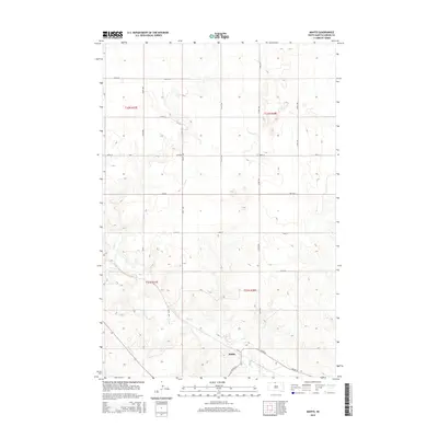
2015 Map of Mahto
USGS Topo · Published 2015About this map
Mahto is situated in the southeastern portion of this landscape, serving as a primary point of settlement along the intersection of Bia Rd 44 and 113th St. This area of Corson County is defined by a grid of rural section lines, including 269th Ave and 106th St, which organize the rolling geography of the Standing Rock Reservation. The winding course of Oak Cr cuts through the southwestern and central sections of the survey, providing the primary hydrological feature in an otherwise dry, upland environment. The road network, composed of both Bureau of Indian Affairs routes and county roads like Co Rd, illustrates the infrastructure connecting remote homesteads and agricultural tracts. This 2015 data reflects the persistent township and range divisions of t22n r27e and t21n r28e, which continue to dictate the placement of roads and boundaries across the Dakota plains.
Find a feature on this map
20 named features on this map. Tap any name to fly to it.
Don’t see what you’re looking for? This feature index may not catch every label — zoom into the map to look around manually.
Map Details
Editions of this 2015 Mahto Map
This is the sole edition of this map. No revisions or reprints were ever made.
Other maps of this area

1953 · McIntosh
USGS Topo · 1:250,000

1956 · Wakpala NW
USGS Topo · 1:24,000

1956 · Little Eagle
USGS Topo · 1:24,000

1956 · Wakpala
USGS Topo · 1:24,000

1958 · McIntosh
USGS Topo · 1:250,000

1966 · Mahto NE
USGS Topo · 1:24,000

1966 · McLaughlin
USGS Topo · 1:24,000

1966 · McLaughlin NE
USGS Topo · 1:24,000

1966 · Mahto
USGS Topo · 1:24,000

1966 · Mahto NW
USGS Topo · 1:24,000