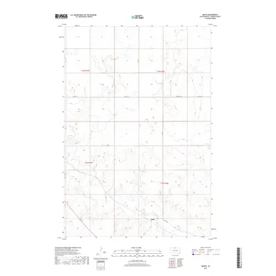
2017 Map of Mahto
USGS Topo · Published 2017About this map
Mahto stands as the primary settlement on this landscape, situated near the southern boundary where the expansive prairie topography is carved by the winding course of Oak Cr. The drainage patterns of the creek and its numerous unnamed tributaries define the movement across this portion of Corson Co RD, showing a network of rural routes that provide access to the high plains. Section lines of the Public Land Survey System, including t22n r27e, t22n r28e, t21n r27e, and t21n r28e, organize the territory into a grid of ranching and agricultural allotments. The transportation infrastructure relies on a system of county roads such as Kenel Rd and Mahto Rd, which connect the small community to the wider regional geography of South Dakota.
Find a feature on this map
14 named features on this map. Tap any name to fly to it.
Don’t see what you’re looking for? This feature index may not catch every label — zoom into the map to look around manually.
Map Details
Editions of this 2017 Mahto Map
This is the sole edition of this map. No revisions or reprints were ever made.
Other maps of this area

1953 · McIntosh
USGS Topo · 1:250,000

1956 · Wakpala NW
USGS Topo · 1:24,000

1956 · Little Eagle
USGS Topo · 1:24,000

1956 · Wakpala
USGS Topo · 1:24,000

1958 · McIntosh
USGS Topo · 1:250,000

1966 · Mahto NE
USGS Topo · 1:24,000

1966 · McLaughlin
USGS Topo · 1:24,000

1966 · McLaughlin NE
USGS Topo · 1:24,000

1966 · Mahto
USGS Topo · 1:24,000

1966 · Mahto NW
USGS Topo · 1:24,000