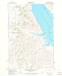
1966 Map of Mahto NE
USGS Topo · Published 1967About this map
The Standing Rock Indian Reservation Boundary defines much of this landscape along the border of North and South Dakota in the mid-1960s. The massive Oahe Reservoir dominates the eastern portion of the sheet, having transformed the original course of the Missouri River into a wide expanse of water. This inundation created deep inlets such as State Line Bay, where the two states meet amidst complex county lines involving Sioux, Corson, Emmons, and Campbell counties.
Find a feature on this map
14 named features on this map. Tap any name to fly to it.
Don’t see what you’re looking for? This feature index may not catch every label — zoom into the map to look around manually.
Map Details
Editions of this 1966 Mahto NE Map
2 editions found
Other maps of this area

1953 · McIntosh
USGS Topo · 1:250,000

1954 · Bismarck
USGS Topo · 1:250,000

1958 · Bismarck
USGS Topo · 1:250,000

1958 · McIntosh
USGS Topo · 1:250,000

1966 · Mahto NE
USGS Topo · 1:24,000

1966 · Mahto
USGS Topo · 1:24,000

1966 · Kenel
USGS Topo · 1:24,000

1966 · Mahto NW
USGS Topo · 1:24,000

1966 · Kline Buttes
USGS Topo · 1:24,000

1966 · Pollock NW
USGS Topo · 1:24,000