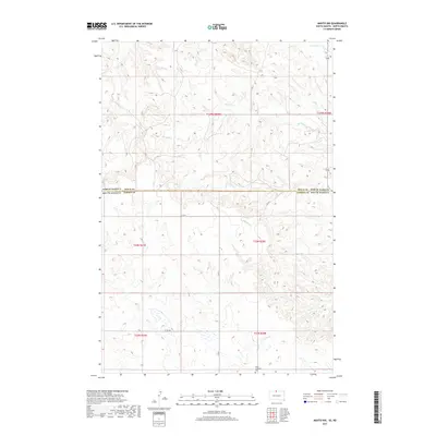
2017 Map of Mahto NW
USGS Topo · Published 2017About this map
Hope Lutheran Cem sits near the southern boundary of this high plains landscape, where the state line between North Dakota and South Dakota divides Sioux and Corson counties. The terrain is defined by the drainage patterns of several seasonal waterways, including the winding course of Joe Bush Cr in the north and the southward-flowing Blackfoot Cr. In the northeastern corner, Fireheart Cr skirts the edge of the survey area. This 2017 edition illustrates the sparse rural infrastructure of the Standing Rock region, where primary access is maintained via Co Rd 5 and local routes like 271st Ave. The map provides a precise look at the Public Land Survey System grid, detailing sections across multiple townships such as t129n r80w and t23n r28e, essential for tracing land ownership and family history in this border country.
Find a feature on this map
14 named features on this map. Tap any name to fly to it.
Don’t see what you’re looking for? This feature index may not catch every label — zoom into the map to look around manually.
Map Details
Editions of this 2017 Mahto NW Map
This is the sole edition of this map. No revisions or reprints were ever made.
Other maps of this area

1953 · McIntosh
USGS Topo · 1:250,000

1954 · Bismarck
USGS Topo · 1:250,000

1958 · Bismarck
USGS Topo · 1:250,000

1958 · McIntosh
USGS Topo · 1:250,000

1966 · Mahto NE
USGS Topo · 1:24,000

1966 · McLaughlin
USGS Topo · 1:24,000

1966 · McLaughlin NE
USGS Topo · 1:24,000

1966 · Mahto
USGS Topo · 1:24,000

1966 · Mahto NW
USGS Topo · 1:24,000

1966 · Kline Buttes
USGS Topo · 1:24,000