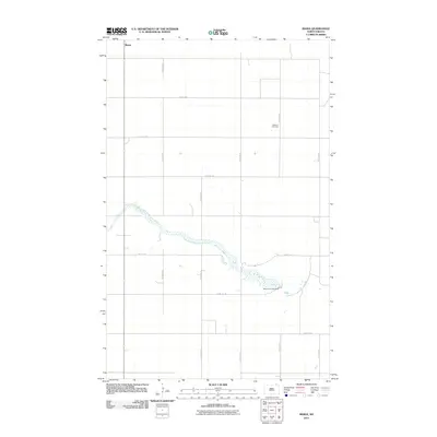
2011 Map of Maida
USGS Topo · Published 2011About this map
Maida sits at the northern edge of the Cavalier County plains, positioned just below the international boundary in this 2011 survey. The landscape is defined by the strict geometry of the section line road system, including routes like 107th Ave NE and 108th St NE, which partition the agricultural expanse. Breaking this grid is the winding course of the Little South Pembina River, which snakes across the southern half of the map before reaching the Mount Carmel Dam. For those researching local family history, the Elkwood Cemetery remains a significant landmark within the otherwise open township. The map illustrates a contemporary rural environment where water management and traditional land divisions continue to shape the character of the North Dakota borderlands.
Find a feature on this map
16 named features on this map. Tap any name to fly to it.
Don’t see what you’re looking for? This feature index may not catch every label — zoom into the map to look around manually.
Map Details
Editions of this 2011 Maida Map
This is the sole edition of this map. No revisions or reprints were ever made.
Other maps of this area

1953 · Devils Lake
USGS Topo · 1:250,000

1956 · Devils Lake
USGS Topo · 1:250,000

1967 · Langdon East
USGS Topo · 1:24,000

1967 · Maida
USGS Topo · 1:24,000

1969 · Olga SW
USGS Topo · 1:24,000

1969 · Olga NW
USGS Topo · 1:24,000

1970 · Mount Carmel
USGS Topo · 1:24,000

1970 · Langdon West
USGS Topo · 1:24,000

1985 · Langdon
USGS Topo · 1:100,000

2011 · Mount Carmel
USGS Topo · 1:24,000