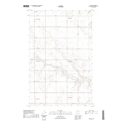
2017 Map of Maida
USGS Topo · Published 2017About this map
Maida sits at the northern edge of this North Dakota landscape, situated directly against the international border in Cavalier County. The terrain is defined by the winding course of the Little Pembina River, which carves a distinct valley through the prairie as it flows toward the southeast. This 2017 survey reflects a sparsely populated agricultural region, where the grid of sections is traced by a network of local roads including Elkwood Rd and Mt Carmel Rd. The presence of the Elkwood Cem in the northeastern portion of the map provides a touchstone for local genealogy, marking the site of early community burials in this borderland territory. The landscape remains largely open, dominated by the natural drainage patterns of the river valley and the enduring structure of the Public Land Survey System.
Find a feature on this map
27 named features on this map. Tap any name to fly to it.
Don’t see what you’re looking for? This feature index may not catch every label — zoom into the map to look around manually.
Map Details
Editions of this 2017 Maida Map
This is the sole edition of this map. No revisions or reprints were ever made.
Other maps of this area

1953 · Devils Lake
USGS Topo · 1:250,000

1956 · Devils Lake
USGS Topo · 1:250,000

1967 · Langdon East
USGS Topo · 1:24,000

1967 · Maida
USGS Topo · 1:24,000

1969 · Olga SW
USGS Topo · 1:24,000

1969 · Olga NW
USGS Topo · 1:24,000

1970 · Mount Carmel
USGS Topo · 1:24,000

1970 · Langdon West
USGS Topo · 1:24,000

1985 · Langdon
USGS Topo · 1:100,000

2011 · Mount Carmel
USGS Topo · 1:24,000