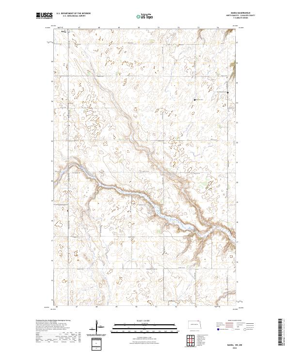
2024 Map of Maida
USGS Topo · Published 2024About this map
Maida sits at the northern edge of this North Dakota landscape, situated just south of the international border where the prairie begins its gradual descent toward the Little South Pembina River valley. The map reveals a transition from the level agricultural fields of the upland plains to the more intricate, winding coulees that define the river's drainage basin. This area in Cavalier County is marked by a precise grid of rural roads, including Maida Rd and Elkwood Rd, which connect isolated farmsteads and agricultural operations. Local history is anchored by the presence of Elkwood Cem and East Elkwood Cem, which serve as quiet markers of the early families who settled this frontier region. The intersection of Cavalier Co Hwy 55 and Mt Carmel Rd highlights the vital transportation routes that have supported the northern wheat-growing economy for generations.
Find a feature on this map
29 named features on this map. Tap any name to fly to it.
Don’t see what you’re looking for? This feature index may not catch every label — zoom into the map to look around manually.
Map Details
Editions of this 2024 Maida Map
This is the sole edition of this map. No revisions or reprints were ever made.
Other maps of this area

1953 · Devils Lake
USGS Topo · 1:250,000

1956 · Devils Lake
USGS Topo · 1:250,000

1967 · Langdon East
USGS Topo · 1:24,000

1967 · Maida
USGS Topo · 1:24,000

1969 · Olga SW
USGS Topo · 1:24,000

1969 · Olga NW
USGS Topo · 1:24,000

1970 · Mount Carmel
USGS Topo · 1:24,000

1970 · Langdon West
USGS Topo · 1:24,000

1985 · Langdon
USGS Topo · 1:100,000

2011 · Mount Carmel
USGS Topo · 1:24,000