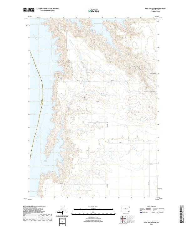
2021 Map of Mail Shack Creek
USGS Topo · Published 2021About this map
The Missouri River and the expansive waters of Lake Oahe dominate the western edge of this South Dakota landscape, defining the border between Stanley and Sully counties. The terrain rising from the river breaks into a complex network of draws and ridges, most notably Sully Buttes and the deep incision of Bakers Gulch. This modern survey illustrates the rural grid system that organizes the high plains, with numbered section lines like 184th St and 278th Ave providing access to the interior. Small drainages such as Mail Shack Creek and Sully Creek cut through the landscape toward the reservoir, marking the natural hydrology that persists despite the managed water levels of the dammed Missouri. The presence of recreational and residential naming conventions, such as Little Bend Dr and Pike Haven Pl, points to the contemporary use of the lakefront for more than just agriculture.
Find a feature on this map
30 named features on this map. Tap any name to fly to it.
Don’t see what you’re looking for? This feature index may not catch every label — zoom into the map to look around manually.
Map Details
Editions of this 2021 Mail Shack Creek Map
This is the sole edition of this map. No revisions or reprints were ever made.
Other maps of this area

1954 · Pierre
USGS Topo · 1:250,000

1958 · Pierre
USGS Topo · 1:250,000

1965 · Artichoke Butte SW
USGS Topo · 1:24,000

1965 · Okobojo
USGS Topo · 1:24,000

1969 · No Heart Creek SE
USGS Topo · 1:24,000

1969 · No Heart Creek SW
USGS Topo · 1:24,000
1973 · Iron Post Buttes SE
USGS Topo · 1:24,000

1973 · Iron Post Buttes SW
USGS Topo · 1:24,000

1973 · Iron Post Buttes
USGS Topo · 1:24,000
1973 · Okobojo SW
USGS Topo · 1:24,000