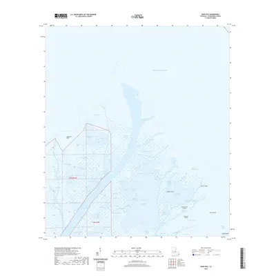
2020 Map of Main Pass
USGS Topo · Published 2020About this map
Spoonbill Bend and Tessiers Bend define the northern reaches of this coastal landscape in Plaquemines Parish, where the Mississippi River delta meets the Gulf of Mexico. The area is a complex network of wetlands and tidal passes, including Cottam Pass and Delta Pass, which navigate between shifting landmasses. The map documents numerous named ponds such as Blackbird Pond, Piling Pond, and Flatboat Pond, illustrating the high degree of fragmentation in the marsh. Isolated land features like Gaspar Island and Timber Island rise above the surrounding waters, connected by waterways such as Gaspar Bayou and Battery Bayou. This 2020 survey provides a recent look at the hydrological patterns of the lower delta, tracing the named channels and passes like Octave Pass and Scarabin Pass that are vital to local navigation and ecosystem management.
Find a feature on this map
69 named features on this map. Tap any name to fly to it.
Don’t see what you’re looking for? This feature index may not catch every label — zoom into the map to look around manually.
Map Details
Editions of this 2020 Main Pass Map
This is the sole edition of this map. No revisions or reprints were ever made.
Other maps of this area

1893 · East Delta
USGS Topo · 1:62,500

1893 · Forts
USGS Topo · 1:62,500

1893 · West Delta
USGS Topo · 1:62,500

1935 · Taylor Pass
USGS Topo · 1:31,680

1947 · Pass A Loutre West
USGS Topo · 1:31,680

1947 · Venice
USGS Topo · 1:31,680

1947 · Main Pass
USGS Topo · 1:31,680

1947 · Pass A Loutre East
USGS Topo · 1:31,680

1948 · Forts
USGS Topo · 1:62,500

1949 · Cubits Gap
USGS Topo · 1:31,680