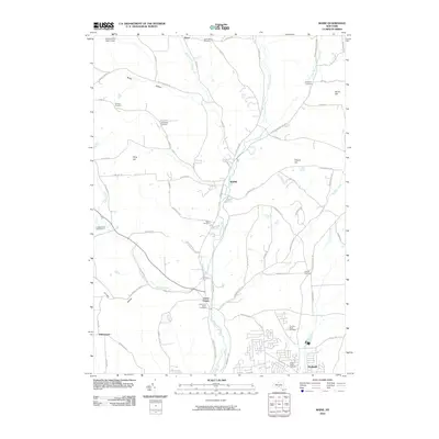
2010 Map of Maine
USGS Topo · Published 2010About this map
Nanticoke Creek and its various tributaries, including the Ketchumville Branch, shape the rural and suburban layout of Broome County at the start of the 21st century. The landscape is dotted with ancestral burial grounds, such as the Hollenbeck Cemetery and Allentown Cemetery, reflecting generations of settlement in the hills. The community of Maine serves as a central point, while Union Center and the northern edge of Endwell show more developed residential patterns to the south. Distinctive land use is evident in the presence of the Ketchumville State Forest and the Crocker Creek Buffalo Farm, illustrating a mix of public conservation and private agricultural ventures. Numerous family-named landmarks like Pollard Hill and Hardy Hill overlook the winding network of roads such as Union Center Maine Hwy and Pollard Hill Rd.
Find a feature on this map
75 named features on this map. Tap any name to fly to it.
Don’t see what you’re looking for? This feature index may not catch every label — zoom into the map to look around manually.
Map Details
Editions of this 2010 Maine Map
This is the sole edition of this map. No revisions or reprints were ever made.
Other maps of this area

1901 · Apalachin
USGS Topo · 1:62,500

1903 · Harford
USGS Topo · 1:62,500

1904 · Binghamton
USGS Topo · 1:62,500

1904 · Greene
USGS Topo · 1:62,500

1904 · Apalachin
USGS Topo · 1:62,500

1906 · Catatonk
USGS Topo · 1:125,000

1934 · Castle Creek
USGS Topo · 1:24,000

1935 · Binghamton West
USGS Topo · 1:24,000

1942 · Binghamton West
USGS Topo · 1:31,680

1942 · Castle Creek
USGS Topo · 1:31,680