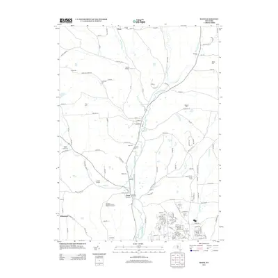
2013 Map of Maine
USGS Topo · Published 2013About this map
Maine and Union Center anchor the valley of Nanticoke Cr in this Broome County survey, showing a landscape defined by small settlements and family history. Numerous burial grounds, such as the Hollenbeck Cem and Allentown Cem, are scattered across the hills, marking the generational presence of local families. The terrain transitions from the heights of King Hill and Hardy Hill down to the creek-side centers, where the community's agricultural roots remain visible at sites like the Crocker Creek Buffalo Farm.
Find a feature on this map
142 named features on this map. Tap any name to fly to it.
Don’t see what you’re looking for? This feature index may not catch every label — zoom into the map to look around manually.
Map Details
Editions of this 2013 Maine Map
This is the sole edition of this map. No revisions or reprints were ever made.
Other maps of this area

1901 · Apalachin
USGS Topo · 1:62,500

1903 · Harford
USGS Topo · 1:62,500

1904 · Binghamton
USGS Topo · 1:62,500

1904 · Greene
USGS Topo · 1:62,500

1904 · Apalachin
USGS Topo · 1:62,500

1906 · Catatonk
USGS Topo · 1:125,000

1934 · Castle Creek
USGS Topo · 1:24,000

1935 · Binghamton West
USGS Topo · 1:24,000

1942 · Binghamton West
USGS Topo · 1:31,680

1942 · Castle Creek
USGS Topo · 1:31,680