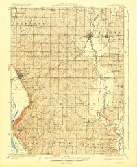
1926 Map of Maitland
USGS Topo · Published 1926About this map
Maitland and Mound City anchor this rural landscape in Holt County during the mid-1920s, a period defined by a dense network of one-room schoolhouses and country churches. The Nodaway River meanders along the eastern edge, forming a natural boundary near Graham, while the Chicago Burlington and Quincy railroad cuts through the western terrain to serve the local agricultural economy.
Find a feature on this map
60 named features on this map. Tap any name to fly to it.
Don’t see what you’re looking for? This feature index may not catch every label — zoom into the map to look around manually.
Map Details
Editions of this 1926 Maitland Map
3 editions found
Other maps of this area

1885 · Atchison
USGS Topo · 1:125,000

1888 · Atchison
USGS Topo · 1:125,000

1893 · Atchison
USGS Topo · 1:125,000

1920 · Craig
USGS Topo · 1:62,500

1924 · St. Joseph
USGS Topo · 1:62,500

1926 · Saint Joseph
USGS Topo · 1:62,500

1926 · Oregon
USGS Topo · 1:62,500

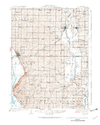
1926 · Maitland
USGS Topo · 1:62,500

1927 · Bolckow
USGS Topo · 1:62,500

1939 · Tarkio
USGS Topo · 1:62,500