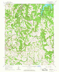
1966 Map of Makanda
USGS Topo · Published 1967About this map
Giant City State Park dominates this Illinois landscape, where the sandstone bluffs and hills of the Shawnee National Forest meet the southern edge of the glaciated plains. The Illinois Central railroad cuts through the terrain, serving the village of Makanda and the town of Cobden, centers for the local fruit-growing industry of the mid-twentieth century. Higher elevations are marked by landmarks like Tiptop Knob and the Water Valley Lookout Tower, which provided surveillance over the dense woodlands.
Find a feature on this map
48 named features on this map. Tap any name to fly to it.
Don’t see what you’re looking for? This feature index may not catch every label — zoom into the map to look around manually.
Map Details
Editions of this 1966 Makanda Map
3 editions found
Other maps of this area

1920 · Jonesboro
USGS Topo · 1:62,500

1920 · Dongola
USGS Topo · 1:62,500

1922 · Carbondale
USGS Topo · 1:62,500

1923 · Dongola
USGS Topo · 1:62,500

1923 · Jonesboro
USGS Topo · 1:62,500

1924 · Alto Pass
USGS Topo · 1:62,500

1941 · Carbondale
USGS Topo · 1:62,500

1947 · Jonesboro
USGS Topo · 1:62,500

1947 · Alto Pass
USGS Topo · 1:62,500
1947 · Cobden
USGS Topo · 1:24,000