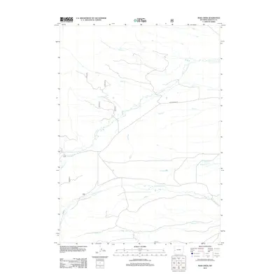
2012 Map of Maki Creek
USGS Topo · Published 2012About this map
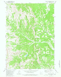
Greenwood Springs lies at the heart of this drainage basin in Sublette County, where various forks of Cottonwood Creek converge. The landscape is defined by its hydrology, with Cottonwood Creek, North Cottonwood Creek, and South Cottonwood Creek carving paths through the high country. Human activity is marked by a network of forest and public land routes, notably North Cottonwood Road and various numbered Bureau of Land Management tracks like BLM 5217. The map illustrates a classic Western rangeland environment where named water sources like Maki Creek and Killpecker Creek were essential for navigation and land management. Genealogists and historians can use these named drainages, such as Mickelson Creek and Halverson Creek, to pinpoint historical grazing allotments or early land claims in this part of Wyoming.
Find a feature on this map
21 named features on this map. Tap any name to fly to it.
Don’t see what you’re looking for? This feature index may not catch every label — zoom into the map to look around manually.
Map Details
Editions of this 2012 Maki Creek Map
This is the sole edition of this map. No revisions or reprints were ever made.
Other maps of this area

1921 · Afton
USGS Topo · 1:125,000

1939 · Big Piney
USGS Topo · 1:125,000

1942 · Big Piney
USGS Topo · 1:125,000

1955 · Preston
USGS Topo · 1:250,000

1958 · Preston
USGS Topo · 1:250,000

1962 · Preston
USGS Topo · 1:250,000
1980 · Red Castle Creek
USGS Topo · 1:24,000
1980 · Merna
USGS Topo · 1:24,000
1980 · Triple Peak
USGS Topo · 1:24,000
1980 · Mount Schidler
USGS Topo · 1:24,000