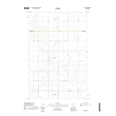
2017 Map of Makoti SW
USGS Topo · Published 2017About this map
Deepwater Cr and its tributaries, including the E Fork Deepwater Cr, carve through this section of the Missouri Plateau along the border of Mountrail and McLean counties. The landscape is dotted with numerous small wetlands and prairie potholes, characteristic of the region's glaciated terrain, with Lake Susie serving as a prominent local landmark. This 2017 survey reflects the enduring rural character of the area, where the section-line road grid, including 24th St NW and 31st St NW, organizes the agricultural plains. For those researching local history or genealogy, the map identifies key community sites such as the Bethlehem Lutheran Cem and Roseglen Cem, which stand as quiet markers of the families who settled this part of North Dakota.
Find a feature on this map
20 named features on this map. Tap any name to fly to it.
Don’t see what you’re looking for? This feature index may not catch every label — zoom into the map to look around manually.
Map Details
Editions of this 2017 Makoti SW Map
This is the sole edition of this map. No revisions or reprints were ever made.
Other maps of this area

1953 · Watford City
USGS Topo · 1:250,000

1954 · McClusky
USGS Topo · 1:250,000

1956 · Makoti SW
USGS Topo · 1:24,000

1956 · Blackwater Lake NW
USGS Topo · 1:24,000

1956 · Blackwater Lake
USGS Topo · 1:24,000

1956 · Roseglen
USGS Topo · 1:24,000

1957 · Watford City
USGS Topo · 1:250,000

1958 · McClusky
USGS Topo · 1:250,000

1967 · Watford City
USGS Topo · 1:250,000

1967 · Raub
USGS Topo · 1:24,000