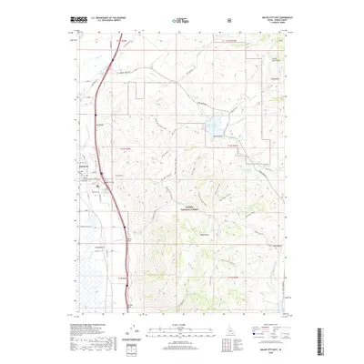
2020 Map of Malad City East
USGS Topo · Published 2020About this map
Malad City serves as the focal point of this 2020 landscape, where the Oneida County Courthouse and Malad City Cem mark the heart of the settlement in Malad Valley. The transition from town to high country is immediate, as the eastern horizon is dominated by the Malad Range and the vast boundaries of the Caribou National Forest. Water management is central to this high-desert region, evidenced by the infrastructure of the Deep Creek Reservoir and Upper Deep Cr Reservoir nestled within the canyons.
Find a feature on this map
67 named features on this map. Tap any name to fly to it.
Don’t see what you’re looking for? This feature index may not catch every label — zoom into the map to look around manually.
Map Details
Editions of this 2020 Malad City East Map
This is the sole edition of this map. No revisions or reprints were ever made.
Other maps of this area

1954 · Pocatello
USGS Topo · 1:250,000

1958 · Pocatello
USGS Topo · 1:250,000

1968 · Samaria
USGS Topo · 1:24,000

1968 · Malad Summit
USGS Topo · 1:24,000

1968 · Oxford
USGS Topo · 1:24,000

1968 · Malad City West
USGS Topo · 1:24,000

1968 · Malad City East
USGS Topo · 1:24,000
1968 · Henderson Creek
USGS Topo · 1:24,000

1968 · Clifton
USGS Topo · 1:24,000
1968 · Weston Canyon
USGS Topo · 1:24,000