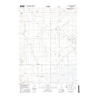
2017 Map of Malad City West
USGS Topo · Published 2017About this map
The Little Malad River flows through the heart of the Malad Valley, anchoring a landscape defined by its irrigation infrastructure and rural settlements. On the eastern edge of this 2017 survey, Malad City serves as the regional hub, supported by the Malad City Airport and a grid of local roads like Bannock St and Samaria Ln. To the north, the Saint Johns Reservoir and the community of Saint Johns mark the transition toward the higher elevations of the Caribou National Forest.
Find a feature on this map
92 named features on this map. Tap any name to fly to it.
Don’t see what you’re looking for? This feature index may not catch every label — zoom into the map to look around manually.
Map Details
Editions of this 2017 Malad City West Map
This is the sole edition of this map. No revisions or reprints were ever made.
Other maps of this area

1954 · Pocatello
USGS Topo · 1:250,000

1958 · Pocatello
USGS Topo · 1:250,000

1963 · Daniels
USGS Topo · 1:24,000

1968 · Ireland Springs
USGS Topo · 1:24,000

1968 · Grover Canyon
USGS Topo · 1:24,000

1968 · Samaria
USGS Topo · 1:24,000

1968 · Daniels
USGS Topo · 1:24,000

1968 · Malad Summit
USGS Topo · 1:24,000

1968 · Malad City West
USGS Topo · 1:24,000

1968 · Malad City East
USGS Topo · 1:24,000