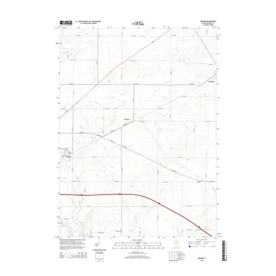
2015 Map of Malden
USGS Topo · Published 2015About this map
Malden and the smaller settlements of Zearing and Arlington anchor this portion of Bureau County, characterized by a precision-grid road network and the meandering courses of the Bureau Creek system. The landscape is defined by its agricultural layout, with long thoroughfares like Angling Rd cutting diagonally across the standard section lines. Water resources are prominent throughout the area, from the winding Big Bureau Cr and E Bureau Cr to the southeastern flow of Brush Cr and the secluded Beaver Glenn Lake. Local history is preserved in small geographic markers such as the Malden Cemetery and the Bereans Cem, which sit alongside the rural avenues. This survey provides a clear view of the modern rural infrastructure and water drainage patterns that have shaped this Illinois prairie land.
Find a feature on this map
52 named features on this map. Tap any name to fly to it.
Don’t see what you’re looking for? This feature index may not catch every label — zoom into the map to look around manually.
Map Details
Editions of this 2015 Malden Map
This is the sole edition of this map. No revisions or reprints were ever made.
Other maps of this area

1893 · Hennepin
USGS Topo · 1:62,500

1893 · Lasalle
USGS Topo · 1:62,500

1909 · Hennepin
USGS Topo · 1:62,500

1911 · La Salle
USGS Topo · 1:62,500

1911 · Hennepin
USGS Topo · 1:62,500

1913 · La Salle
USGS Topo · 1:62,500

1947 · La Salle
USGS Topo · 1:62,500

1951 · Amboy
USGS Topo · 1:62,500

1952 · Mendota
USGS Topo · 1:62,500

1958 · Aurora
USGS Topo · 1:250,000