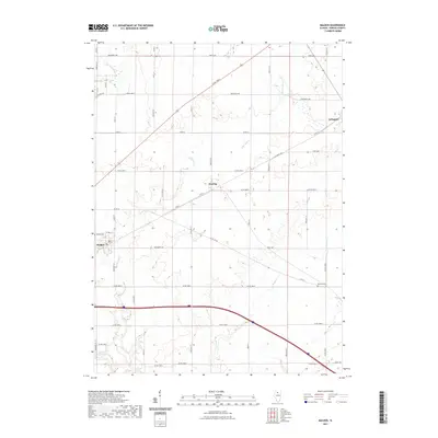
2021 Map of Malden
USGS Topo · Published 2021About this map
Big Bureau Cr and its tributaries, including E Bureau Cr and Brush Cr, carve a meandering path through this Bureau County agricultural landscape. The small villages of Arlington, Zearing, and Malden anchor the survey, connected by a rigid grid of rural routes like 2400 North Ave and Co Rd 12. For local historians and genealogists, the map identifies specific community landmarks such as Malden Cem and Berean Cem. The presence of Beaver Glenn Lake in the southwest corner provides a contrast to the surrounding drainage networks. The map documents a classic Midwestern layout where century-old settlement patterns persist alongside modern infrastructure, reflecting the enduring rural character of north-central Illinois.
Find a feature on this map
33 named features on this map. Tap any name to fly to it.
Don’t see what you’re looking for? This feature index may not catch every label — zoom into the map to look around manually.
Map Details
Editions of this 2021 Malden Map
This is the sole edition of this map. No revisions or reprints were ever made.
Other maps of this area

1893 · Hennepin
USGS Topo · 1:62,500

1893 · Lasalle
USGS Topo · 1:62,500

1909 · Hennepin
USGS Topo · 1:62,500

1911 · La Salle
USGS Topo · 1:62,500

1911 · Hennepin
USGS Topo · 1:62,500

1913 · La Salle
USGS Topo · 1:62,500

1947 · La Salle
USGS Topo · 1:62,500

1951 · Amboy
USGS Topo · 1:62,500

1952 · Mendota
USGS Topo · 1:62,500

1958 · Aurora
USGS Topo · 1:250,000