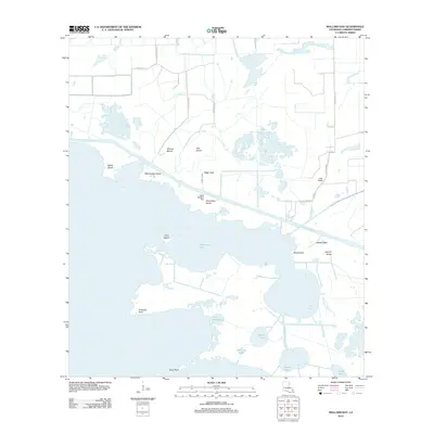
2012 Map of Mallard Bay
USGS Topo · Published 2012About this map
Mermentau Lake dominates this coastal Louisiana landscape, a region defined by a complex network of waterways and marshland islands in Cameron Parish. Human engineering is evident in the straight lines of Canal Number Ten, Ridge Canal, and Lulu Canal, which cut through the natural terrain to facilitate drainage or navigation. These artificial channels contrast with the irregular shorelines of named landforms such as Oak Island, Flat Prairie Island, and Shell Island. The map records a transition from terrestrial parish roads like Parish Road 117 to the open waters of Mallard Bay Island and Lake Monzelum. Notable landmarks such as Umbrella Point and Short Point mark the edges of this hydraulic environment, while smaller water bodies like Floating Lake and Snake Lake highlight the fragmented, shifting nature of the deltaic plain.
Find a feature on this map
31 named features on this map. Tap any name to fly to it.
Don’t see what you’re looking for? This feature index may not catch every label — zoom into the map to look around manually.
Map Details
Editions of this 2012 Mallard Bay Map
This is the sole edition of this map. No revisions or reprints were ever made.
Other maps of this area

1934 · Catfish Lake
USGS Topo · 1:24,000

1934 · Latania Lake
USGS Topo · 1:24,000

1935 · Catfish Lake
USGS Topo · 1:31,680

1935 · Latania Lake
USGS Topo · 1:31,680

1946 · Lake Arthur
USGS Topo · 1:31,680

1947 · Thornwell
USGS Topo · 1:31,680

1949 · Gueydan
USGS Topo · 1:31,680

1952 · Lake Charles
USGS Topo · 1:250,000

1954 · Grand Lake East NW
USGS Topo · 1:31,680

1954 · Grand Lake East SE
USGS Topo · 1:31,680