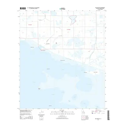
2015 Map of Mallard Bay
USGS Topo · Published 2015About this map
The Intracoastal Waterway bisects this low-lying coastal landscape, serving as a critical artery for marine traffic through the marshy expanse of Cameron Parish. This 2015 perspective illustrates the complex transition between open water and fragmented landmasses, defined by significant features like Mallard Bay and the northern reaches of Grand Lake. The hydrological network is remarkably dense, featuring a grid-like system of man-made cuts such as Lulu Canal and Ridge Canal that interlace with natural drainages like Latanier Bayou. Several named landforms emerge from the surrounding wetlands, including Perreau Island, Oak Island, and the distinctive Umbrella Point. The map provides a detailed view of the infrastructure supporting this coastal region, from the winding path of Oak Ridge Rd to the various parish roads that provide access to these remote reaches of the Louisiana shoreline.
Find a feature on this map
31 named features on this map. Tap any name to fly to it.
Don’t see what you’re looking for? This feature index may not catch every label — zoom into the map to look around manually.
Map Details
Editions of this 2015 Mallard Bay Map
This is the sole edition of this map. No revisions or reprints were ever made.
Other maps of this area

1934 · Catfish Lake
USGS Topo · 1:24,000

1934 · Latania Lake
USGS Topo · 1:24,000

1935 · Catfish Lake
USGS Topo · 1:31,680

1935 · Latania Lake
USGS Topo · 1:31,680

1946 · Lake Arthur
USGS Topo · 1:31,680

1947 · Thornwell
USGS Topo · 1:31,680

1949 · Gueydan
USGS Topo · 1:31,680

1952 · Lake Charles
USGS Topo · 1:250,000

1954 · Grand Lake East NW
USGS Topo · 1:31,680

1954 · Grand Lake East SE
USGS Topo · 1:31,680