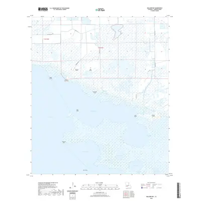
2020 Map of Mallard Bay
USGS Topo · Published 2020About this map
Maple Marsh and the surrounding coastal wetlands of Cameron Parish define this landscape where the terrestrial plains of southwestern Louisiana meet the gulf. The Intracoastal Waterway cuts a straight path across the marsh, serving as a critical artery for maritime transport between Grand Lake and the eastern marshes. This region is a complex network of shallow basins and landforms, including Mallard Bay and Umbrella Bay, separated by subtle elevations like Flat Prairie Island and Perreau Island.
Find a feature on this map
31 named features on this map. Tap any name to fly to it.
Don’t see what you’re looking for? This feature index may not catch every label — zoom into the map to look around manually.
Map Details
Editions of this 2020 Mallard Bay Map
This is the sole edition of this map. No revisions or reprints were ever made.
Other maps of this area

1934 · Catfish Lake
USGS Topo · 1:24,000

1934 · Latania Lake
USGS Topo · 1:24,000

1935 · Catfish Lake
USGS Topo · 1:31,680

1935 · Latania Lake
USGS Topo · 1:31,680

1946 · Lake Arthur
USGS Topo · 1:31,680

1947 · Thornwell
USGS Topo · 1:31,680

1949 · Gueydan
USGS Topo · 1:31,680

1952 · Lake Charles
USGS Topo · 1:250,000

1954 · Grand Lake East NW
USGS Topo · 1:31,680

1954 · Grand Lake East SE
USGS Topo · 1:31,680