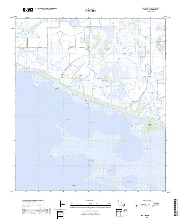
2024 Map of Mallard Bay
USGS Topo · Published 2024About this map
Grand Lake and Mallard Bay dominate this low-lying coastal landscape in Cameron Parish, where a complex network of marshes and waterways defines the terrain. The presence of the Intracoastal Waterway provides a vital east-west transit corridor through the wetlands, intersecting local channels like the Ridge Canal and Lulu Canal. Small topographic rises, locally identified as islands, dot the marshland, including Perreau Island, Oak Island, and Flat Prairie Island, which likely offered higher ground for early cattle grazing or seasonal activities.
Find a feature on this map
32 named features on this map. Tap any name to fly to it.
Don’t see what you’re looking for? This feature index may not catch every label — zoom into the map to look around manually.
Map Details
Editions of this 2024 Mallard Bay Map
This is the sole edition of this map. No revisions or reprints were ever made.
Other maps of this area

1934 · Catfish Lake
USGS Topo · 1:24,000

1934 · Latania Lake
USGS Topo · 1:24,000

1935 · Catfish Lake
USGS Topo · 1:31,680

1935 · Latania Lake
USGS Topo · 1:31,680

1946 · Lake Arthur
USGS Topo · 1:31,680

1947 · Thornwell
USGS Topo · 1:31,680

1949 · Gueydan
USGS Topo · 1:31,680

1952 · Lake Charles
USGS Topo · 1:250,000

1954 · Grand Lake East NW
USGS Topo · 1:31,680

1954 · Grand Lake East SE
USGS Topo · 1:31,680