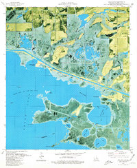
1979 Map of Mallard Bay
USGS Topo · Published 1980About this map
Maple Marsh dominates the northern reaches of this coastal landscape, where the interplay of land and water is defined by a network of drainage and transport canals. The Intracoastal Waterway cuts a straight path through the wetlands, separating the marsh from the complex island and bay systems to the south. This orthophotomap, produced in 1979, reveals the industrial footprint of the era, specifically the Grand Lake Oil and Gas Field and the Mallard Bay Oil and Gas Field.
Find a feature on this map
40 named features on this map. Tap any name to fly to it.
Don’t see what you’re looking for? This feature index may not catch every label — zoom into the map to look around manually.
Map Details
Editions of this 1979 Mallard Bay Map
This is the sole edition of this map. No revisions or reprints were ever made.
Other maps of this area

1934 · Catfish Lake
USGS Topo · 1:24,000

1934 · Latania Lake
USGS Topo · 1:24,000

1935 · Catfish Lake
USGS Topo · 1:31,680

1935 · Latania Lake
USGS Topo · 1:31,680

1946 · Lake Arthur
USGS Topo · 1:31,680

1947 · Thornwell
USGS Topo · 1:31,680

1949 · Gueydan
USGS Topo · 1:31,680

1952 · Lake Charles
USGS Topo · 1:250,000

1954 · Grand Lake East NW
USGS Topo · 1:31,680

1954 · Grand Lake East SE
USGS Topo · 1:31,680