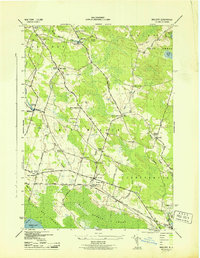
1943 Map of Mallory
USGS Topo · Published 1943About this map
The New York Ontario and Western railroad corridor anchors this mid-century survey of Oswego County, tracing the northern edge of the Big Bay Swamp and Toad Harbor Swamp. This low-lying drainage area, situated just north of Oneida Lake, defined the settlement patterns of the era, forcing villages and farmsteads toward higher ground like Whig Hill and The Pinnacle. The map reveals a densely organized rural school system, with numbered districts such as School No 11 near Mallory and School No 8 serving the surrounding agricultural landscape.
Find a feature on this map
42 named features on this map. Tap any name to fly to it.
Don’t see what you’re looking for? This feature index may not catch every label — zoom into the map to look around manually.
Map Details
Editions of this 1943 Mallory Map
This is the sole edition of this map. No revisions or reprints were ever made.
Other maps of this area

1895 · Chittenango
USGS Topo · 1:62,500

1895 · Syracuse
USGS Topo · 1:62,500

1898 · Syracuse
USGS Topo · 1:62,500

1898 · Chittenango
USGS Topo · 1:62,500

1902 · Chittenango
USGS Topo · 1:62,500

1905 · Mexico
USGS Topo · 1:62,500

1906 · Kasoag
USGS Topo · 1:62,500

1940 · Brewerton
USGS Topo · 1:24,000

1940 · Cicero
USGS Topo · 1:24,000

1941 · Cleveland
USGS Topo · 1:24,000