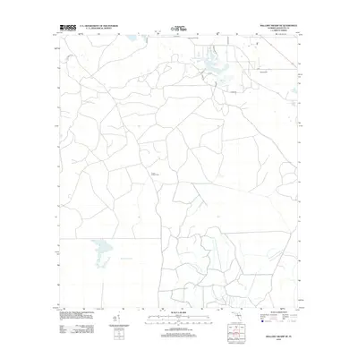
2012 Map of Mallory Swamp NE
USGS Topo · Published 2012About this map
Mallory Swamp dominates the southern reaches of this Lafayette County landscape, a terrain defined by wet lowlands and isolated cypress heads. This 2012 survey reveals a transition from these wetlands to the agricultural and timber lands further north, where fire management infrastructure like the Midway Fire Tower and Crapps Lookout Tower overlook the pine plantations and forest stands. The presence of several small water bodies, including Picket Lake and Adams Lake, indicates the importance of local hydrology to the area's development.
Find a feature on this map
19 named features on this map. Tap any name to fly to it.
Don’t see what you’re looking for? This feature index may not catch every label — zoom into the map to look around manually.
Map Details
Editions of this 2012 Mallory Swamp NE Map
This is the sole edition of this map. No revisions or reprints were ever made.
Other maps of this area

1954 · Mallory Swamp NW
USGS Topo · 1:24,000

1954 · Mallory Swamp SW
USGS Topo · 1:24,000

1954 · Mallory Swamp SE
USGS Topo · 1:24,000

1954 · Mallory Swamp NE
USGS Topo · 1:24,000

1954 · Gainesville
USGS Topo · 1:250,000

1954 · Valdosta
USGS Topo · 1:250,000

1955 · Mayo
USGS Topo · 1:24,000

1955 · Mayo SE
USGS Topo · 1:24,000
1956 · Mallory Swamp NW
USGS Topo · 1:25,000

1956 · Mallory Swamp SE
USGS Topo · 1:25,000