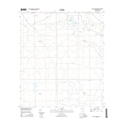
2015 Map of Mallory Swamp NE
USGS Topo · Published 2015About this map
Maypop Cem sits as a quiet landmark amidst the swampy lowlands of Lafayette County in this 2015 U.S. Geological Survey representation. The landscape is defined by a dense grid of rural roads and tracks, including SE Walker Grade Rd and SE Crapps Tower Rd, which navigate the township and range boundaries of t6s r12e and t6s r13e. The northern edge of the map features several distinct bodies of water such as Picket Lake, Adams Lake, and Golden Lake. The presence of these lakes, paired with named tracks like SE Lakeshore Blvd, suggests a localized cluster of activity or seasonal dwellings in an otherwise sparsely populated Florida wetlands environment. The thoroughfare of E Us 27 clips the northeastern corner, providing a primary link to the broader region beyond the swamp drainage.
Find a feature on this map
37 named features on this map. Tap any name to fly to it.
Don’t see what you’re looking for? This feature index may not catch every label — zoom into the map to look around manually.
Map Details
Editions of this 2015 Mallory Swamp NE Map
This is the sole edition of this map. No revisions or reprints were ever made.
Other maps of this area

1954 · Mallory Swamp NW
USGS Topo · 1:24,000

1954 · Mallory Swamp SW
USGS Topo · 1:24,000

1954 · Mallory Swamp SE
USGS Topo · 1:24,000

1954 · Mallory Swamp NE
USGS Topo · 1:24,000

1954 · Gainesville
USGS Topo · 1:250,000

1954 · Valdosta
USGS Topo · 1:250,000

1955 · Mayo
USGS Topo · 1:24,000

1955 · Mayo SE
USGS Topo · 1:24,000
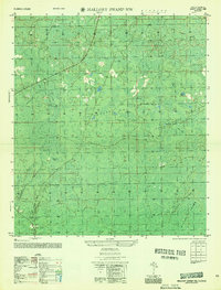
1956 · Mallory Swamp NW
USGS Topo · 1:25,000

1956 · Mallory Swamp SE
USGS Topo · 1:25,000