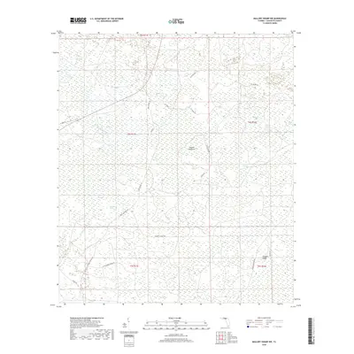
2018 Map of Mallory Swamp NW
USGS Topo · Published 2018About this map
The Steinhatchee River cuts through the western reaches of this Lafayette County landscape, a territory defined by a complex network of wetlands and namesake bays. The topography is subtle, punctuated by slight rises such as Brushy Hammock and Driggers Ridge, which provided dry ground for early land use and access. Local history and genealogy researchers will find value in the named hydrological features that served as essential landmarks for generations, including Johnson Bay, Bird Pond, and White Pond. The transport network of the late 2010s relies on a grid of secondary routes like SE McCray Rd and SE Turkey Rd, which snake through the timberlands and marshes, connecting scattered clearings with more established thoroughfares like Hines Hwy. This area's transition from a wild riverine swamp to a managed landscape of forestry and rural transit is etched into the labels of its quiet basins and ridges.
Find a feature on this map
33 named features on this map. Tap any name to fly to it.
Don’t see what you’re looking for? This feature index may not catch every label — zoom into the map to look around manually.
Map Details
Editions of this 2018 Mallory Swamp NW Map
This is the sole edition of this map. No revisions or reprints were ever made.
Other maps of this area

1954 · Mallory Swamp NW
USGS Topo · 1:24,000

1954 · Day SE
USGS Topo · 1:24,000

1954 · Clara
USGS Topo · 1:24,000

1954 · Mallory Swamp SW
USGS Topo · 1:24,000

1954 · Cooks Hammock
USGS Topo · 1:24,000

1954 · Mallory Swamp SE
USGS Topo · 1:24,000

1954 · Mallory Swamp NE
USGS Topo · 1:24,000

1954 · Gainesville
USGS Topo · 1:250,000

1954 · Valdosta
USGS Topo · 1:250,000

1955 · Mayo
USGS Topo · 1:24,000