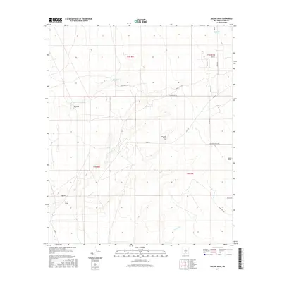
2017 Map of Malone Draw
USGS Topo · Published 2017About this map
Malone Draw and the enigmatic Lost River anchor this topographic view of the arid Chihuahuan Desert landscape in Otero County. The terrain is defined by a series of ephemeral watercourses including Laborcita Arroyo, Hay Draw, and Red Arroyo, which trace the drainage patterns across the High Rolls transition. The map reveals a land utilized for ranching and military purposes, evidenced by the Mesa Verde Ranch Strip and the proximity of Wsmr Part 9. While modern roads like Alamogordo Dr and Phillips Ave appear in the southeast, the interior remains sparsely developed, characterized by utility features like Daugherty Tank and local routes such as Danley Ranch Rd. This survey documents the intersection of rural residential expansion and traditional high-desert land use at the dawn of the twenty-first century.
Find a feature on this map
29 named features on this map. Tap any name to fly to it.
Don’t see what you’re looking for? This feature index may not catch every label — zoom into the map to look around manually.
Map Details
Editions of this 2017 Malone Draw Map
This is the sole edition of this map. No revisions or reprints were ever made.
Other maps of this area

1916 · Tularosa
USGS Topo · 1:125,000

1916 · Point Of Sands
USGS Topo · 1:125,000

1948 · Tularosa
USGS Topo · 1:62,500

1948 · Holloman
USGS Topo · 1:62,500

1950 · Alamogordo
USGS Topo · 1:62,500

1950 · Mescalero
USGS Topo · 1:62,500

1954 · Carlsbad
USGS Topo · 1:250,000

1954 · Tularosa
USGS Topo · 1:250,000

1955 · Las Cruces
USGS Topo · 1:250,000

1955 · Roswell
USGS Topo · 1:250,000