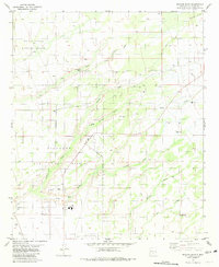
1981 Map of Malone Draw
USGS Topo · Published 1981About this map
Military installations and ephemeral watercourses define this arid landscape in the Tularosa Basin during the early 1980s. The northwest corner is occupied by the White Sands Missile Range, while the Holloman Air Force Base dominates the central and southern sections, including a designated firing range and multiple surveillance structures like a radio tower and observation tower.
Find a feature on this map
27 named features on this map. Tap any name to fly to it.
Don’t see what you’re looking for? This feature index may not catch every label — zoom into the map to look around manually.
Map Details
Editions of this 1981 Malone Draw Map
This is the sole edition of this map. No revisions or reprints were ever made.
Other maps of this area

1916 · Tularosa
USGS Topo · 1:125,000

1916 · Point Of Sands
USGS Topo · 1:125,000

1948 · Tularosa
USGS Topo · 1:62,500

1948 · Holloman
USGS Topo · 1:62,500

1950 · Alamogordo
USGS Topo · 1:62,500

1950 · Mescalero
USGS Topo · 1:62,500

1954 · Carlsbad
USGS Topo · 1:250,000

1954 · Tularosa
USGS Topo · 1:250,000

1955 · Las Cruces
USGS Topo · 1:250,000

1955 · Roswell
USGS Topo · 1:250,000