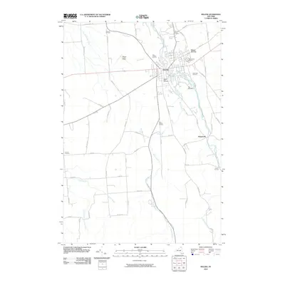
2010 Map of Malone
USGS Topo · Published 2010About this map
Malone serves as the central hub of this northern New York landscape, situated at the confluence of the Salmon River and Branch Brook. The 2010 geography reveals a community anchored by numerous historical burial grounds, including the Morningside Cemetery, Notre Dame Cemetery, and the Webster Street Cemetery, which provide significant points of reference for genealogists and local historians. North of the village center, Malone Junction indicates the historical importance of rail connections in the region, while the Malone-Dufort Airport sits to the west. Outside the primary settlement, the terrain transitions into a network of farm-to-market roads and rural outposts like Whippleville. The natural landscape is defined by its waterways, from Plum Brook in the north to the East Branch Little Salmon River in the southwest, and prominent elevations such as The Pinnacle overlooking the river valley.
Find a feature on this map
60 named features on this map. Tap any name to fly to it.
Don’t see what you’re looking for? This feature index may not catch every label — zoom into the map to look around manually.
Map Details
Editions of this 2010 Malone Map
This is the sole edition of this map. No revisions or reprints were ever made.
Other maps of this area

1906 · Loon Lake
USGS Topo · 1:62,500

1908 · Loon Lake
USGS Topo · 1:62,500

1915 · Chateaugay
USGS Topo · 1:62,500

1915 · Malone
USGS Topo · 1:62,500

1917 · Malone
USGS Topo · 1:62,500

1921 · Santa Clara
USGS Topo · 1:62,500

1923 · Santa Clara
USGS Topo · 1:62,500

1943 · Chateaugay
USGS Topo · 1:62,500

1948 · Ogdensburg
USGS Topo · 1:250,000

1951 · Ogdensburg
USGS Topo · 1:250,000