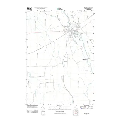
2013 Map of Malone
USGS Topo · Published 2013About this map
The village of Malone serves as a significant regional hub in Franklin County, anchored by the branching waters of the Salmon River and the high point of The Pinnacle. This modern survey illustrates a landscape deeply tied to its local history through an extensive network of community landmarks, including numerous burial grounds such as Morningside Cem, Saint Josephs Cem, and Notre Dame Cem. The transport infrastructure is defined by the intersection of rail history at Malone Junction and aviation at the Malone-Dufort Airport.
Find a feature on this map
121 named features on this map. Tap any name to fly to it.
Don’t see what you’re looking for? This feature index may not catch every label — zoom into the map to look around manually.
Map Details
Editions of this 2013 Malone Map
This is the sole edition of this map. No revisions or reprints were ever made.
Other maps of this area

1906 · Loon Lake
USGS Topo · 1:62,500

1908 · Loon Lake
USGS Topo · 1:62,500

1915 · Chateaugay
USGS Topo · 1:62,500

1915 · Malone
USGS Topo · 1:62,500

1917 · Malone
USGS Topo · 1:62,500

1921 · Santa Clara
USGS Topo · 1:62,500

1923 · Santa Clara
USGS Topo · 1:62,500

1943 · Chateaugay
USGS Topo · 1:62,500

1948 · Ogdensburg
USGS Topo · 1:250,000

1951 · Ogdensburg
USGS Topo · 1:250,000