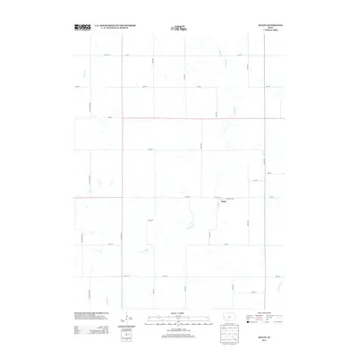
2013 Map of Maloy
USGS Topo · Published 2013About this map
Maloy stands as the primary settlement in this rural Iowa landscape, situated at the junction of Co HWY-j43 and Co HWY-p14. The town's grid, including local streets like Hillcrest Dr and W St, is defined by its proximity to the winding course of the Platte River. This waterway dominates the central portion of the map, fed by smaller tributaries such as Platte Br and Turkey Cr. The surrounding terrain is organized into a rigid section-line road network, where long stretches of Yellowstone Ave and Winchester Ave intersect with numbered routes like 270th St. In the southeastern corner, the Grand River makes a brief appearance, marking the edge of a watershed system that has shaped the agricultural development and property lines of Taylor County for generations.
Find a feature on this map
29 named features on this map. Tap any name to fly to it.
Don’t see what you’re looking for? This feature index may not catch every label — zoom into the map to look around manually.
Map Details
Editions of this 2013 Maloy Map
This is the sole edition of this map. No revisions or reprints were ever made.
Other maps of this area

1940 · Blockton
USGS Topo · 1:62,500

1940 · Bedford
USGS Topo · 1:62,500

1943 · Bedford
USGS Topo · 1:62,500

1943 · Blockton
USGS Topo · 1:62,500

1955 · Nebraska City
USGS Topo · 1:250,000

1957 · Nebraska City
USGS Topo · 1:250,000

1958 · Nebraska City
USGS Topo · 1:250,000

1980 · Merle Junction
USGS Topo · 1:24,000
1980 · Conway
USGS Topo · 1:24,000
1980 · Sheridan
USGS Topo · 1:24,000