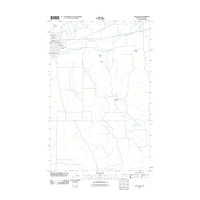
2011 Map of Malta East
USGS Topo · Published 2011About this map
Malta serves as the primary hub for this portion of Phillips County, situated along the meandering path of the Milk River. The landscape is defined by an extensive network of irrigation infrastructure essential to the local agricultural economy, most notably the Dodson South Canal, which traverses the terrain alongside the Bowdoin Canal. These water systems, coupled with landmarks like the Dodson South Canal Bridge and Hillbilly Dam, reveal the human effort to manage the semi-arid environment of northern Montana.
Find a feature on this map
20 named features on this map. Tap any name to fly to it.
Don’t see what you’re looking for? This feature index may not catch every label — zoom into the map to look around manually.
Map Details
Editions of this 2011 Malta East Map
This is the sole edition of this map. No revisions or reprints were ever made.
Other maps of this area

1905 · Bowdoin
USGS Topo · 1:62,500

1954 · Glasgow
USGS Topo · 1:250,000

1957 · Glasgow
USGS Topo · 1:250,000

1958 · Glasgow
USGS Topo · 1:250,000

1968 · Malta West
USGS Topo · 1:24,000
1968 · Malta NE
USGS Topo · 1:24,000

1968 · Malta East
USGS Topo · 1:24,000
1968 · Malta NW
USGS Topo · 1:24,000

1984 · Clanton Coulee
USGS Topo · 1:24,000
1984 · Lake Bowdoin
USGS Topo · 1:24,000