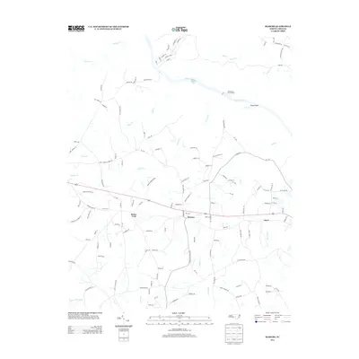
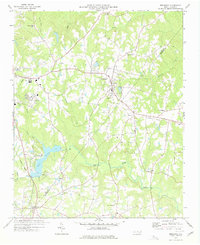
2013 Map of Mamers
USGS Topo · Published 2013About this map
Mamers sits at the heart of this Harnett County landscape, serving as a focal point for a network of rural roads and watercourses. The drainage of the Cape Fear River dominates the northern portion of the quadrangle, featuring geographic landmarks like Buckner Falls and the Northington Lock and Dam. The terrain is deeply articulated by numerous creeks, including Daniels Cr, Cedar Cr, and Camels Cr, which create the undulating topography characteristic of this part of North Carolina. To the west, the community of Boone Trail anchors a series of family-named roads such as Patterson Rd and Garland Sloan Ln, which reflect the localized settlement patterns of the area. Further east, the small settlement of Luart appears along the highway corridor, while the Upper Little River defines the southern boundary. This 2013 survey provides a clear view of the area's transition from river-bottom land to upland rural development.
Find a feature on this map
130 named features on this map. Tap any name to fly to it.
Don’t see what you’re looking for? This feature index may not catch every label — zoom into the map to look around manually.
Map Details
Editions of this 2013 Mamers Map
This is the sole edition of this map. No revisions or reprints were ever made.
Other maps of this area

1953 · Raleigh
USGS Topo · 1:250,000

1954 · Raleigh
USGS Topo · 1:250,000

1956 · Anderson Creek
USGS Topo · 1:24,000

1956 · Bunnlevel
USGS Topo · 1:24,000
1957 · Olivia
USGS Topo · 1:24,000

1970 · Moncure
USGS Topo · 1:24,000
1974 · Fuquay-Varina
USGS Topo · 1:24,000

1974 · Mamers
USGS Topo · 1:24,000
1974 · Cokesbury
USGS Topo · 1:24,000
1977 · Broadway
USGS Topo · 1:24,000