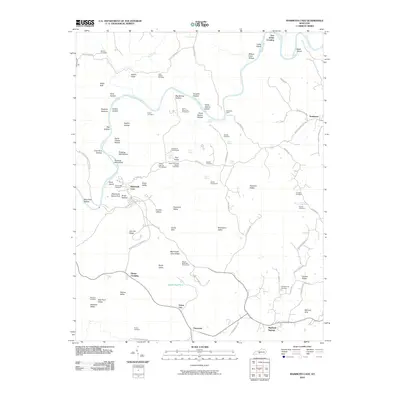
2010 Map of Mammoth Cave
USGS Topo · Published 2010About this map
Mammoth Cave and its subterranean network shape the karst topography of this Kentucky landscape, where the surface is defined by a dense concentration of sinks, hollows, and ridges. The Green River snakes through the northern half of the sheet, passing landmarks like Floating Mill Island and the Dennison Ferry crossing. A network of early 21st-century infrastructure supports the park area, including the Adwell Pumphouse and Great Onyx Cave Pumphouse. Genealogy interest is particularly high here due to numerous family and community burial sites, such as the Old Guides Cemetery and the Mammoth Cave Baptist Cemetery. Small settlements and historic crossroads like Chaumont, Sloans Crossing, and Union City anchor the southern roads, while the complex terrain features unique names like Goblin Knob, Nappers Rollover, and Double Cellars.
Find a feature on this map
96 named features on this map. Tap any name to fly to it.
Don’t see what you’re looking for? This feature index may not catch every label — zoom into the map to look around manually.
Map Details
Editions of this 2010 Mammoth Cave Map
This is the sole edition of this map. No revisions or reprints were ever made.
Other maps of this area

1922 · Mammoth Cave
USGS Topo · 1:62,500

1923 · Mammoth Cave
USGS Topo · 1:62,500

1925 · Cub Run
USGS Topo · 1:62,500

1934 · Munfordville
USGS Topo · 1:48,000

1935 · Horse Cave
USGS Topo · 1:48,000

1937 · Munfordville
USGS Topo · 1:62,500

1938 · Horse Cave
USGS Topo · 1:62,500

1953 · Munfordville
USGS Topo · 1:24,000

1954 · Evansville
USGS Topo · 1:250,000

1954 · Horse Cave
USGS Topo · 1:24,000