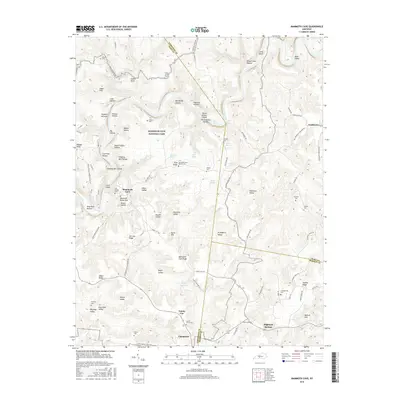
2016 Map of Mammoth Cave
USGS Topo · Published 2016About this map
Mammoth Cave National Park dominates this terrain, revealing the complex subterranean and surface topography of central Kentucky. The map highlights the famous Mammoth Cave entrance alongside a high concentration of cemeteries that speak to the area's ancestral history, such as Old Guides Cem and the Mammoth Cave Baptist Cem. Small settlements like Chaumont and Union City sit south of the park boundary, while Northtown is located to the northeast.
Find a feature on this map
103 named features on this map. Tap any name to fly to it.
Don’t see what you’re looking for? This feature index may not catch every label — zoom into the map to look around manually.
Map Details
Editions of this 2016 Mammoth Cave Map
This is the sole edition of this map. No revisions or reprints were ever made.
Other maps of this area

1922 · Mammoth Cave
USGS Topo · 1:62,500

1923 · Mammoth Cave
USGS Topo · 1:62,500

1925 · Cub Run
USGS Topo · 1:62,500

1934 · Munfordville
USGS Topo · 1:48,000

1935 · Horse Cave
USGS Topo · 1:48,000

1937 · Munfordville
USGS Topo · 1:62,500

1938 · Horse Cave
USGS Topo · 1:62,500

1953 · Munfordville
USGS Topo · 1:24,000

1954 · Evansville
USGS Topo · 1:250,000

1954 · Horse Cave
USGS Topo · 1:24,000