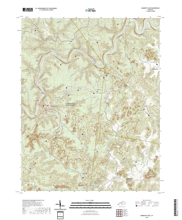
2022 Map of Mammoth Cave
USGS Topo · Published 2022About this map
The Green River carves a deep path through this limestone landscape, defining the topography of Mammoth Cave National Park. This survey reveals a subterranean world rising to the surface through features like Mammoth Dome Sink, Echo River, and the entrance to Mammoth Cave. Outside the park boundaries, the land is marked by small settlements such as Northtown and Union City, and numerous family burial grounds including the Meredith Family Cem and Franklin Johnson Cem. The transportation history of the area is uniquely preserved in the Mammoth Cave Railroad Bike And Hike Trl, which follows the route of a former rail line that once brought early tourists to the cavern entrance. The map provides a look at the karst geology of Flint Ridge and Houchins Valley, where springs like Adwell Spring and Pike Spring emerge from the complex drainage system.
Find a feature on this map
123 named features on this map. Tap any name to fly to it.
Don’t see what you’re looking for? This feature index may not catch every label — zoom into the map to look around manually.
Map Details
Editions of this 2022 Mammoth Cave Map
This is the sole edition of this map. No revisions or reprints were ever made.
Other maps of this area

1922 · Mammoth Cave
USGS Topo · 1:62,500

1923 · Mammoth Cave
USGS Topo · 1:62,500

1925 · Cub Run
USGS Topo · 1:62,500

1934 · Munfordville
USGS Topo · 1:48,000

1935 · Horse Cave
USGS Topo · 1:48,000

1937 · Munfordville
USGS Topo · 1:62,500

1938 · Horse Cave
USGS Topo · 1:62,500

1953 · Munfordville
USGS Topo · 1:24,000

1954 · Evansville
USGS Topo · 1:250,000

1954 · Horse Cave
USGS Topo · 1:24,000